In a typical day, Woodstock’s Pizza in isla vista, California, will make about 60 deliveries across the lunch and dinner dayparts.
To homes, office complexes, industrial spots and the nearby campus of University of California, Santa Barbara (UCSB), a daily staff of 10 Woodstock’s drivers will hit doors across the Isla Vista area. The sheer number of deliveries, including some to less traveled parts of town, Woodstock’s marketing representative Jeff Willis confesses, leaves room for errors, wrong turns and delays.
“When you have that many drivers out on the road, mistakes can happen,” Willis says, recalling one driver who got lost on his return trip from a nearby oil refinery. “he hadn’t been in that area before and mistook a left for a right.”
Fortunately, pizzeria operators and drivers alike have a number of contemporary tools capable of streamlining the delivery process.
With GPS, satellite images, smartphones, and customizable mapping solutions, we’ve come a long way from the rand McNally road atlas. Though a trusty part of any delivery driver’s arsenal, the traditional printed map has largely given way to tech-charged solutions that make delivery execution more efficient and predictable.
In recent years, many pizzerias, including independent stores like Woodstock’s, have turned to customized delivery maps in which operators identify the center of the map, typically their restaurant, and then select a custom area defined by radius, distance, or drive time. at Woodstock’s, for instance, red lines define different delivery zones and each zone’s accompanying fee.
Featuring large graphics, high detail levels and an a-to-z street directory, these printed maps help staff easily locate an address, verify its place in the delivery area and approximate delivery time. Drivers, meanwhile, can use the map as a large-scale visual tool to plan their route.
Robert Burns, director of marketing at California-based Maps.com, a provider of mapping products to businesses, says that while drivers might utilize a GPS or smartphone to travel from the store to a customer, the customized overview maps assist in the journey’s planning stage and provide a level of detail and reliability absent in digital solutions.
“Print maps provide a quick reference (and) instant answers that digital solutions do not,” Burns says, adding that operators utilizing a Maps.com solution can define the size of their map and finishing treatment. “This really benefits independent and small chains the most, where they have very specific delivery areas or where multiple stores serve adjacent areas.”
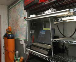
At Woodstock’s, Willis has observed a “huge improvement” in driver performance since the store posted its customized map in late 2011. he says many of his drivers use the poster- sized map, which sits directly above the driver’s station, as an easy-to-read reference tool to understand where they’re heading. on the road, drivers can then pull out their smartphone or a GPS unit as necessary.
“Our map has become an essential communication tool. There is now less confusion about driving areas, fewer lost drivers, and fewer mistakes,” Willis says.
Another no-frills, but tech-enabled tool, driver map books provide extensive on-the-go details on specific communities. Often laminated, these portable maps can include a whole territory or different subsets with extensive details for convenience of use.
“These are most popular to break larger territories into smaller pieces and hand out to drivers to keep in their vehicles,” says Jorge Azpilicueta of DeliveryMaps.com, a leading resource for delivery maps and applications.
On the more high-tech side, digital maps can offer the same level of detail and data as the printed options, but be integrated into POS systems.
Digital maps “are very useful for zooming and viewing with more detail any portion of the map,” Azpilicueta says, noting that many single-store operations tend to favor wall maps, digital maps, driver maps or a combination of the three to plan delivery routes, while larger chains invest in more complex applications to automate the routing.
DeliveryMaps.com can also create web applications, the most high-tech — and costly — of all delivery solutions. Typical web applications provide an interactive interface that allows operators to customize delivery routes, provide directions, offer time estimates, and identify alternative routes. Maps can then be created and printed for each delivery.
Azpilicueta says the web application technology is best suited for small chains with five to 10 stores to larger regional or national chains. he adds that operators using web applications have access to a custom-made system to organize deliveries, as well as the ability to match the delivery address against the territories assigned to each store location. The system can then decide which store should receive a given order.
“Clients can improve delivery times, reduce delivery costs, and save all this information for further use analysis,” Azpilicueta says.
As technology continues its charge, Burns says future driver solutions might include enhanced visualizations, as well as mapping of customers and deliveries against demographics.
“This would enable even the owner- operated business to see who the customers are and tailor offers and publicity to suit,” Burns says. “This type of software is currently used by major multiples, but in many smaller stores is the type of data that the owner carries in their head, sometimes inaccurately.”
Chicago-based writer Daniel P.Smith has covered business issues and best practices for a variety of trade publications,newspapers, and magazines.
